A yellow weather warning for thunderstorms has been issued for much of the UK, with the Met Office alert covering most of southern and northern England as well as the Midlands. This warning comes into force at 12am on Thursday and ends at 11.59pm the same day.
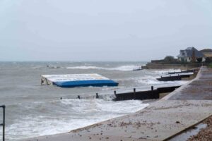
“Heavy showers and thunderstorms are expected to develop on Thursday and may lead to some disruption,” the Met Office said. The agency warned that spray and sudden flooding could lead to difficult driving conditions and some road closures. “Where flooding or lightning strikes occur, there is a chance of delays and some cancellations to train and bus services,” the Met Office added. Additionally, there is potential for power cuts to homes and businesses.
This weather alert follows yellow heat health warnings issued across most of England by the UK Health Security Agency (UKHSA). Forecasters predict the UK could see its hottest day of the year in the coming days, with an official heatwave likely to be declared. The UKHSA warned that the heat conditions may have “significant impacts” on the health and social care sector, particularly in the South East and London.
All areas of England, except the North East and North West, are included in the heat health warning, which remains in place until Wednesday. London could see highs of 32C (89.6F) by Tuesday, while other parts of the country will experience temperatures four or five degrees warmer than average for this time of year, according to the Met Office. Heatwave thresholds could be reached in some areas from Tuesday. The threshold is met when a location records at least three consecutive days with maximum temperatures exceeding a designated value. This is 25C (77F) for most of the UK, rising to 28C (82.4F) in London and its surrounding area.
Met Office spokesperson Nicola Maxey noted that London and the South East could see temperatures around 30C (86F) today, while it will be cooler nearer the coast. However, conditions are expected to become increasingly unsettled in the days ahead. “As we move into the middle of the week, we start to see an increasing risk of thunderstorms developing, particularly in parts of England and Wales,” she said. “The rain is such that it could cause some local disruption. This is the sort of rainfall that could cause surface water flooding and heavy rain that takes a while to clear away. There could also be some lightning, potential for hail, and gusty conditions.” Cooler temperatures are expected to return by next weekend.
Last week, the Met Office revealed that the average number of days with temperatures of 30C or above had trebled in Britain. The UK’s climate is still getting sunnier, wetter, and warmer. Scientists noted that the extreme conditions seen in 2023 – including the warmest June on record – could be a “cool year” by contrast in the UK by the end of the century.