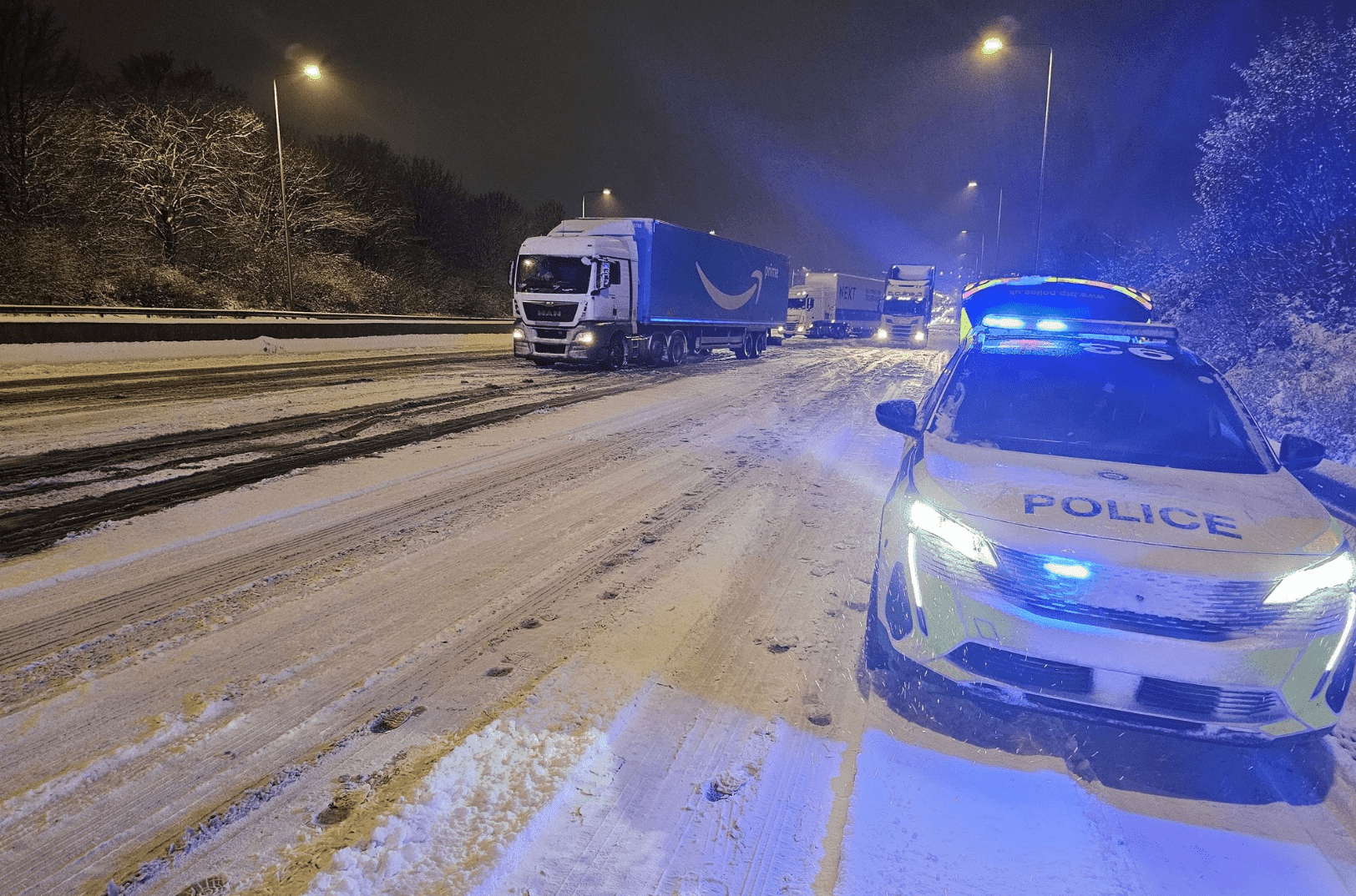
Britain is gearing up for a turbulent start to the New Year, with gusts of up to 75mph expected to lash parts of the country, and temperatures plummeting as low as minus 9°C in certain areas.
As people prepare to welcome in 2024, they are advised to bundle up and secure their party hats, as snowfall is anticipated to blanket much of Scotland. Simultaneously, a “harsh frost” is expected to grip regions further south.
The Met Office has issued a yellow weather warning for rain in certain regions, warning of heavy downpours that could lead to flooding and disrupt travel.
Over the past three months, Britain has contended with several named storms that have brought severe flooding, blizzards, and even a tornado.
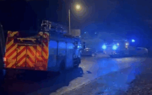
Just this week, Storm Gerrit wreaked havoc across the UK, and meteorologists caution that another low-pressure system is poised to bring additional wet and windy weather.
In England, there are currently 31 flood warnings, indicating that flooding is imminent, and 97 flood alerts, suggesting that flooding is possible.
Meanwhile, Scotland, which has been significantly impacted by Storm Gerrit, has five flood alerts and six flood warnings in effect. In Wales, there are 11 flood alerts.
A yellow weather warning for ice is in place across the north and north-west of Scotland until 10 a.m. this morning, while a yellow warning for rain remains in effect until midnight.
Meteorologist Alex Burkill predicts that northern areas of Scotland are likely to witness “significant snow,” with up to eight inches expected on the highest elevations.
A yellow warning for rain has also been issued by the Met Office for parts of Northern Ireland, extending until 11 a.m., with forecasts indicating rainfall of 15 to 25mm within a few hours.
In a forecast video, Mr Burkill mentioned the likelihood of “a touch of frost” overnight into Saturday. He also pointed out a deep area of low pressure approaching from the Atlantic, set to sweep across the UK over the weekend.
The eastern part of Scotland, particularly Shetland, is expected to experience strong winds and frequent showers. Some frost is “possible” in the south, especially towards the east, while “a more widespread harsh frost” is anticipated in parts of Scotland. Temperatures could plummet to “as low as minus 8°C or 9°C, perhaps a little colder than that,” according to the forecaster.
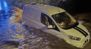
The recent drone footage highlights that parts of the UK have already witnessed significant flooding, including a racecourse in Worcester after the River Severn burst its banks. Large sections of the flood-prone town of Tewkesbury in Gloucestershire have also been submerged by water as Britain continues to grapple with unsettled weather.
Further flooding is expected in England over the next five days, especially in the West Midlands and Yorkshire and the Humber, lasting until Tuesday. Flooding is also possible in parts of the southwest and across the Midlands and the north on both today and Sunday.
As low pressure ushers in more wet and windy weather, the Met Office has issued warnings for heavy rain, strong winds, and snow for this weekend. A wind warning for southern England and Wales is in effect from 11 a.m. until 3 a.m. on Sunday, with rain warnings activated for Wales from 10 a.m. to 6 p.m. and Northern Ireland from 4 a.m. to 11 a.m.
Meteorologists are forecasting flooding, power outages, road, rail, air, and sea travel disruptions, as well as potential delays for high-sided vehicles on exposed routes and bridges. Up to 50mm (2in) of rain could fall in North West Wales, with 25mm (1in) expected elsewhere across the country. Northern Ireland is preparing for up to 25mm (1in) of rain in a few hours, with warnings that the downpours will hit saturated ground.
Additionally, a warning for sleet, snow, and rain has been issued for Scotland from 8 a.m. until midnight, with up to 10cm (4in) of snow predicted on higher ground and 3cm (1.2in) even at lower elevations, alongside 25mm (1in) of rain.
The Met Office has indicated that its Irish counterpart, Met Eireann, may name another storm – Storm Henk – following the disruptions caused by Storm Gerrit around Christmas.
In light of the expected severe weather conditions in the coming days, rail operators have urged passengers to travel today amid concerns over further disruptions and staff shortages on New Year’s Eve. One operator even issued a ‘do not travel’ alert for specific routes on New Year’s Eve.
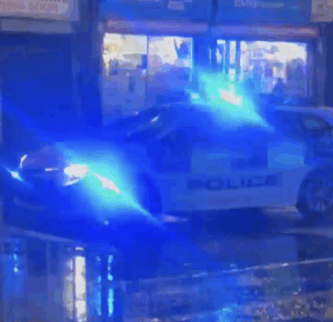
Storm Gerrit, which hit the Tameside town of Stalybridge earlier in the week, prompted Greater Manchester Police to declare a major incident. The supercell thunderstorm resulted in a tornado that damaged 100 homes, felled trees, and caused major structural damage. In North Yorkshire, three men tragically lost their lives when their 4×4 vehicle was submerged in a river.
As a period of sleet and snow, transitioning to rain, threatens to cause flooding and travel disruptions, bus and train services may be affected, leading to longer journey times. Some spray and flooding on roads are expected, along with potential interruptions to power services.
While hundreds of homes in Scotland remain without power, electricity providers are confident that power will be fully restored to the remaining properties soon.
Travel disruptions persist, with rail services impacted in Wales and Scotland. LNER cancelled some trains this morning due to staff shortages, and other services experienced speed restrictions due to a signalling fault north of Newcastle. CrossCountry operated a reduced service due to a “shortage of train crew,” while Avanti West Coast passengers faced further cancellations following disruptions yesterday.
London Underground’s Central and Circle lines faced delays and cancellations due to train shortages. Merseyrail experienced issues due to a signalling fault, and East Midlands Railway had to address a broken-down train at Grimsby. Southeastern commuters experienced delays between Ebbsfleet and St Pancras due to a signalling issue.
In the aftermath of Storm Gerrit earlier in the week, Greater Manchester Police declared a major incident after the supercell thunderstorm hit Stalybridge. A tornado damaged 100 homes, toppled trees, and caused significant structural damage. In another tragic incident, three men lost their lives when their 4×4 vehicle was submerged in a river near Glaisdale in North Yorkshire.
The challenging weather conditions are set to continue, with meteorologists advising travellers to exercise caution and check their journeys before setting off. Passengers are urged to stay informed about the latest travel updates and potential disruptions as they prepare to celebrate the New Year.